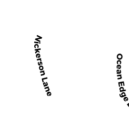
37 OCEAN EDGE DRIVE
Owner Information
BERNSTEIN LYDIA A TRUSTEE
20 MARANT DRIVE
NEEDHAM, MA 02492


Property Details
37 OCEAN EDGE DRIVE is classified as a Residential Condominium (Town house).
The primary structure on this property was built in 1981. There are 1,848ft2 of built area within this property. There is 1,848ft2 of residential/living space within this property. This property is listed as having 5 rooms.
37 OCEAN EDGE DRIVE is valued at $1,381,800. The land is valued at $0 and the structures are valued at $1,377,400. There is an additional valuation of $4,400 on this property.
This property is in Zone RM. Confirm with local Zoning Board authorities to ensure there are no overlays or other easements on this property.
The most recent deed for 37 OCEAN EDGE DRIVE is recorded at the local registrar in Book 31657, Page 164. 37 OCEAN EDGE DRIVE was last sold on Friday, November 9, 2018 for $100.
Assessment data from fiscal year 2022.
Flood Data
This property has multiple flood prone designations.
| Zone | Description | BFE | Area |
|---|---|---|---|
| AE | within floodplain | 13 | 1.27 (16.69%) |
| VE | coastal flooding with wave action | 15 | 1.4 (18.4%) |
This information is sourced from the FEMA National Flood Hazard Layer. See our full disclamer.
Broadband Internet Providers
| Provider | Type | Bandwidth (mbps) | |
|---|---|---|---|
| Viasat Inc | Satellite | 35 | 3 |
| Verizon New England Inc. | DSL | 7 | 0 |
| Comcast | Cable | 1000 | 35 |
| GCI Communication Corp. | Satellite | 0 | 0 |
| HughesNet | Satellite | 25 | 3 |
| VSAT Systems, LLC. | Satellite | 2 | 1 |
Broadband service provider data from December 2020.
Adjacent Properties
- 63 NICKERSON LANE
Residential Condominium owned by OCEAN EDGE RESORT LLC - 65 NICKERSON LANE
Residential Condominium owned by OCEAN EDGE RESORT LLC - 67 NICKERSON LANE
Residential Condominium owned by OCEAN EDGE RESORT LLC - 71 NICKERSON LANE
Residential Condominium owned by OCEAN EDGE RESORT LLC - 79 NICKERSON LANE
Residential Condominium owned by OCEAN EDGE RESORT LLC - 81 NICKERSON LANE
Residential Condominium owned by MEYER KAREN TRUSTEE - 83 NICKERSON LANE
Residential Condominium owned by OCEAN EDGE RESORT LLC - 85 NICKERSON LANE
Residential Condominium owned by OCEAN EDGE RESORT LLC - 89 NICKERSON LANE
Residential Condominium owned by OCEAN EDGE RESORT LLC - 91 NICKERSON LANE
Residential Condominium owned by RANDALL ALEXANDER A TRUSTEE - 93 NICKERSON LANE
Residential Condominium owned by LARK PROPERTIES LLC - 95 NICKERSON LANE
Residential Condominium owned by KASPER KAZMIER - 97 NICKERSON LANE
Residential Condominium owned by CHMURA LINDA W TRUSTEE - 113 NICKERSON LANE
Residential Condominium owned by OCEAN EDGE RESORT LLC - 117 NICKERSON LANE
Residential Condominium owned by OCEAN EDGE RESORT LLC - 119 NICKERSON LANE
Residential Condominium owned by OCEAN EDGE RESORT LLC - 123 NICKERSON LANE
Residential Condominium owned by ROUTE 6A BREWSTER HOLDINGS LLC - 125 NICKERSON LANE
Residential Condominium owned by OCEAN EDGE RESORT LLC - 127 NICKERSON LANE
Residential Condominium owned by OCEAN EDGE RESORT LLC - 100 NICKERSON LANE
Residential Condominium owned by OCEAN EDGE RESORT LLC - 102 NICKERSON LANE
Residential Condominium owned by OCEAN EDGE RESORT LLC - 104 NICKERSON LANE
Residential Condominium owned by OCEAN EDGE RESORT LLC - 106 NICKERSON LANE
Residential Condominium owned by OCEAN EDGE RESORT LLC - 61 NICKERSON LANE
Residential Condominium owned by OCEAN EDGE RESORT LLC - 87 NICKERSON LANE
Residential Condominium owned by OCEAN EDGE RESORT LLC - 121 NICKERSON LANE
Residential Condominium owned by OCEAN EDGE RESORT LLC - 0 NICKERSON LANE
Other, Non-Taxable Condominium Common Land owned by BAY PINES CONDOMINIUM - 73 NICKERSON LANE
Residential Condominium owned by OCEAN EDGE RESORT LLC - 75 NICKERSON LANE
Residential Condominium owned by OCEAN EDGE RESORT LLC - 77 NICKERSON LANE
Residential Condominium owned by OCEAN EDGE RESORT LLC - 99 NICKERSON LANE
Residential Condominium owned by OCEAN EDGE RESORT LLC - 101 NICKERSON LANE
Residential Condominium owned by ROUTE 6A BREWSTER HOLDINGS LLC - 103 NICKERSON LANE
Residential Condominium owned by OCEAN EDGE RESORT LLC - 105 NICKERSON LANE
Residential Condominium owned by ROUTE 6A BREWSTER HOLDINGS LLC - 107 NICKERSON LANE
Residential Condominium owned by JACOVONI ARTHUR J & MARTHA E - 109 NICKERSON LANE
Residential Condominium owned by SHABY CLAIRE S - 111 NICKERSON LANE
Residential Condominium owned by CJ OCEAN EDGE INVESTMENT LLC - 1 SPICEBUSH TERRACE
Residential Condominium owned by DOYLE JOHN E & KATHLEEN TRUSTEES - 2 SPICEBUSH TERRACE
Residential Condominium owned by BRIGGS MARY K - 3 SPICEBUSH TERRACE
Residential Condominium owned by UPTEGROVE CAROL L - 4 SPICEBUSH TERRACE
Residential Condominium owned by NEUWAHL MALCOLM H & EDITH - 5 SPICEBUSH TERRACE
Residential Condominium owned by MURPHY LEO EUGENE & CAROLAN - 6 SPICEBUSH TERRACE
Residential Condominium owned by MOURTZINOS STEPHANIE A - 7 FIELDSTONE TERRACE
Residential Condominium owned by STERLING MARK J & LISA B - 8 FIELDSTONE TERRACE
Residential Condominium owned by MUKERJI RANA & SARAH B TRUSTEES - 9 FIELDSTONE TERRACE
Residential Condominium owned by KINGSTON PAUL J TRUSTEE - 10 FIELDSTONE TERRACE
Residential Condominium owned by KRAMER JEROME H & GRACEMARIE - 11 FIELDSTONE TERRACE
Residential Condominium owned by WALTERS ERIC G & MARYELLEN TRSTEES - 12 FIELDSTONE TERRACE
Residential Condominium owned by BRAGA SUSAN I - 14 FIELDSTONE TERRACE
Residential Condominium owned by 14 FIELDSTONE LLC - 15 FIELDSTONE TERRACE
Residential Condominium owned by 15 FIELDSTONE TERRACE LLC - 16 FIELDSTONE TERRACE
Residential Condominium owned by 16 FIELDSTONE TERRACE LLC - 17 FIELDSTONE TERRACE
Residential Condominium owned by BICKIMER PATRICIA L - 19 MARINER COURT
Residential Condominium owned by POLLACK DAVID B & BERNICE - 20 MARINER COURT
Residential Condominium owned by WECK HANS-JEURGEN & - 21 MARINER COURT
Residential Condominium owned by BARKER DOUGLAS & - 22 MARINER COURT
Residential Condominium owned by HOFMANN GAIL GROSSO & - 23 MARINER COURT
Residential Condominium owned by LARKIN JOAN M TRUSTEE - 24 MARINER COURT
Residential Condominium owned by BEGG KARINE E - 25 MARINER COURT
Residential Condominium owned by REARDON KAREN A - 26 MARINER COURT
Residential Condominium owned by LARK PROPERTIES LLC - 27 MARINER COURT
Residential Condominium owned by MARKS SARA J TRUSTEE - 13 FIELDSTONE TERRACE
Residential Condominium owned by MAURIEL JOHN J & MARY ANNE - 0 OCEAN EDGE DRIVE
Other, Non-Taxable Condominium Common Land owned by OCEAN EDGE I - 18 FIELDSTONE TERRACE
Residential Condominium owned by SCANLAN TIMOTHY & KAREN - 2907 MAIN STREET
Inns, Resorts, or Tourist Homes owned by OCEAN EDGE RESORT LLC